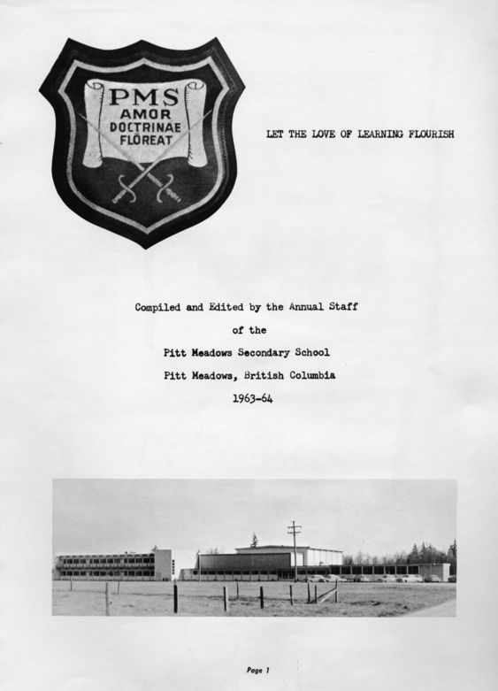
This is a picture of Pitt Meadows Secondary on the cover of the first yearbook 1964.<\/p>\r\n
\r\n
?<\/span>Thank-you to L.Petit for your submission! <\/i><\/span><\/p>","SEO_LINK":"1964-pitt-meadows-secondary","VIDEO_LINK":"","SOUNDCLOUD_LINK":"","IMG1":"1520549730_main_1964-pitt-meadows-secondary_1.jpg","IMG2":"","IMG3":"","IMG4":"","IMG5":"","IMG6":"","IMG7":"","IMG1_THUMB":"1520549730_thumb_1964-pitt-meadows-secondary_1.jpg","IMG2_THUMB":"","IMG3_THUMB":"","IMG4_THUMB":"","IMG5_THUMB":"","IMG6_THUMB":"","IMG7_THUMB":""}X This is a picture of Pitt Meadows Secondary on the cover of the first yearbook 1964. Thank-you to L.Petit for your submission! 1964 Pitt Meadows Secondary
Details:
Latitude: 49.2142975974781
Longitude: -122.68351207825
Direct Link: https://www.pittmeadowsmuseum.com/locations/1964-pitt-meadows-secondary


