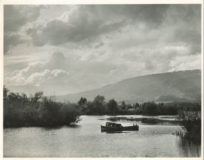
Boat on the Alouette River
This photograph is of a boat on the Alouette River shot from the Neaves Road Bridge c. 1970s. The earliest known inhabitants of the Alouette Watershed area were the Katzie and Douglas-Lillooet first nations, the area was easily accessible and had an abundance of natural resources. Originally this body of water was called Lillooet River until the name was changed in 1914/15 to stop the confusion between the larger Lillooet River. The Alouette River is formed at the confluence of the North and South Alouette Rivers, then the Alouette River flows into the Pitt River and the Pitt River flows into the Fraser River. The Alouette River Management Society currently takes care of the watershed and if you wish to read more about their work we strongly encourage you to check their website https://alouetteriver.org/ They also have a resource about the history of the Alouette Watershed which you can read here: https://alouetteriver.org/history-of-the-alouette-watershed
Details:
Latitude: 49.2497669683621
Longitude: -122.64471422013
Direct Link: https://www.pittmeadowsmuseum.com/locations/boat-on-the-alouette-river


