Over the years the Menzies property was reduced as pieces of the land was sold off. According to the Maple Ridge-Pitt Meadows News \"the current owner now has a demolition permit to remove the structure from the land and is looking to rezone the property as part of a subdivision application.\"
This house has stood there for more than a century and is near historical changes that happened in Pitt Meadows. It was built when there was little more than a dirt trail. The house evidences settler life. Moreover, the location of the house has historical significance because it is above the level of the annual freshet flooding that took place in the area prior to the arrival of Jan Blom and his Associates who built the dykes.
Below is a photo of Robert Struthers standing in front of the Menzies House in the 1940s.","SEO_LINK":"menzies-house","VIDEO_LINK":"","SOUNDCLOUD_LINK":"","IMG1":"1531417544_main_1menzies-house.jpg","IMG2":"","IMG3":"","IMG4":"","IMG5":"","IMG6":"","IMG7":"","IMG1_THUMB":"","IMG2_THUMB":"","IMG3_THUMB":"","IMG4_THUMB":"","IMG5_THUMB":"","IMG6_THUMB":"","IMG7_THUMB":""}X
Menzies House
The Menzies residence is located at 19963 McNeil Rd. William Henry Menzies and his first wife, Mary arrived in the Pitt Meadows/Maple Ridge area in 1891, living first at the Codd Island flats and then at McKenny Creek. By 1898, the family had homesteaded on 160 acres of land on Sheridan Hill, at one time called Menzies’ Mountain. When they arrived, they built a log cabin for their home, but sometime before 1911 they replaced the cabin with a wood framed house, and that house remains on the site to this day.
Over the years the Menzies property was reduced as pieces of the land was sold off. According to the Maple Ridge-Pitt Meadows News "the current owner now has a demolition permit to remove the structure from the land and is looking to rezone the property as part of a subdivision application."
This house has stood there for more than a century and is near historical changes that happened in Pitt Meadows. It was built when there was little more than a dirt trail. The house evidences settler life. Moreover, the location of the house has historical significance because it is above the level of the annual freshet flooding that took place in the area prior to the arrival of Jan Blom and his Associates who built the dykes.
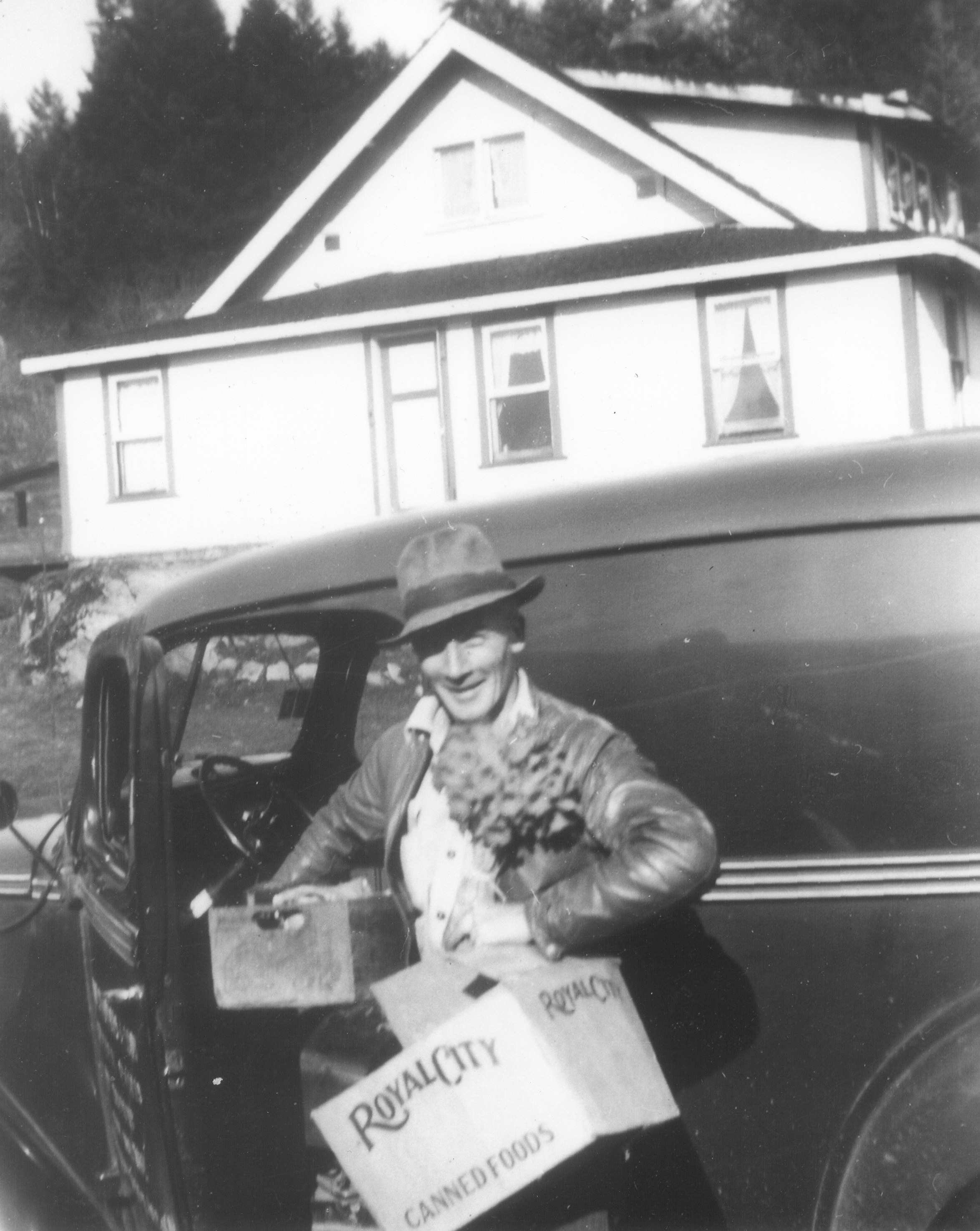
Below is a photo of Robert Struthers standing in front of the Menzies House in the 1940s.
Details:
Latitude: 49.2720040793722
Longitude: -122.66707833812
Direct Link: https://www.pittmeadowsmuseum.com/locations/menzies-house