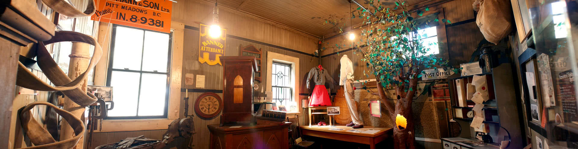
General Store Site 12294 Harris Road Pitt Meadows, B.C.
Click Here for Directions& Visiting Hours


Looking Back: The Road to Pitt Lake
Looking back article from February 2013.
Driving to Pitt Lake and you will travel much of the distance on “Rannie” Road but if you made this trip in the decades before 1997 you would have driven along “Rennie” Road, and we owe the name change to Mary Jo Pearson who battled city hall for six years to ensure her great uncle was remembered accurately in the community.
On 1914/1915 maps in our collection the Road was clearly spelled “Rannie” and this continued to be the case through 1964 when the Pitt Meadows Ratepayers annotated an earlier map and noted “Rannie” Road. However, by the late 1970’s the name was appearing on maps as “Rennie” and this also appears to be the case with street signs. Was this simply a “typo” that took hold?
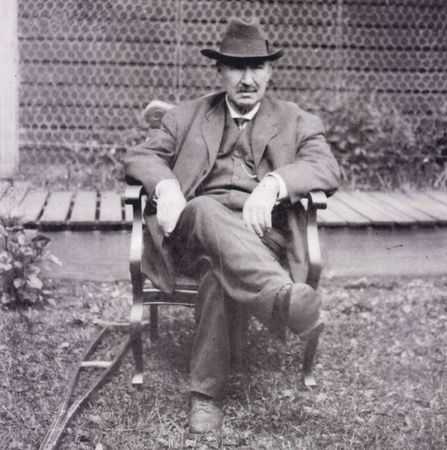
“Skookum” or “Big Bill” Rannie was a larger than life entrepreneur. Born in Campbellford, Ontario around 1863 Rannie worked his way west with the C.P.R. settling on the Coast in 1887 where he and a partner eventually established the contracting firm of Campbell, Rannie and Ironside. Rannie and his partner participated in some of the largest construction projects in the area in the early 20th century including participation in the construction of the Coquitlam to Buntzen Lake tunnel and the B.C. Electric’s New Westminster to Chilliwack line. During the Yukon gold rush “Captain” Rannie and his firm operated the sternwheeler Casca transporting supplies and miners between Whitehorse and Dawson City.
1909 brought a new venture for Rannie when he formed the Pitt Meadows Land Company in order to purchase and reclaim 1679 acres of land in dyking district one north of the Lillooet River. The land had returned to the Dominion Government after the B.C.D.D. Company had been unable to reclaim it and Rannie felt he could succeed where they had failed if he could get the land for a good price. He did secure it for the “nominal amount” of a $1.50 per acre so long as he manage to reclaim it and have it operating by May, 2013. Upon completion his plan was to sell plots for as much as $200.00 per acre.
By the few accounts we have we know Rannie took the venture of reclaiming the land to heart. In an article in “The World” newspaper in 1915 he was promoting that over $200,000.00 in improvements had been made and his project was essentially finished with: 12 1/2 miles of 10 foot high dykes; an electrified pumping plant with 25,000 gallons per minute capacity; flood gates; 70 miles of drainage ditches; and good roads completed. Rannie’s Ranch at the crossing of Sturgeon Slough had many buildings including a massive barn, hay storage, chicken coups and a blacksmith’s shop. But, as with earlier attempts, it was all for naught as the dykes eventually gave way and the pumping station proved inadequate. By the end of WWI Rannie’s company was defunct and his holdings returned to the Crown.
William Rannie died on the 20th of June 1927 and his body was interred at Mountain View Cemetery in Vancouver. Seventy years later, in the summer of 1997, Ms. Pearson won her battle and the District of Pitt Meadows changed signage so the road would once again be known as “Rannie”.
Leslie Norman, Curator at the Pitt Meadows Museum